To understand how the parameters of a fault that generated an earthquake are obtained from InSAR maps, we must preliminarily introduce the concept of model. A model is a tool that reproduces a real phenomenon for the purpose of studying and better understanding it. There are various types of models, but we can distinguish two broad categories: analog models and mathematical models.
For example, to study the impact of earthquakes on a building, we can build a model of the structure and put it on a vibrating platform. It is, in this case, an analog model, which reproduces reality in a small scale. Alternatively, or in addition, we can use mathematical equations in which we put the parameters of the structure and calculate the stresses: we can check, for example, whether the stress to which a column is subjected by a possible earthquake exceeds that expected. This is evidently a mathematical model.
Mathematical models are widespread because they are powerful tools for the use of which all that is needed is a computer, at most very powerful, such as those used for weather forecasting.
For faults we use mathematical models, i.e., equations into which we put the fault parameters(length, width, slope, extent and direction of sliding, etc.) and obtain displacement maps.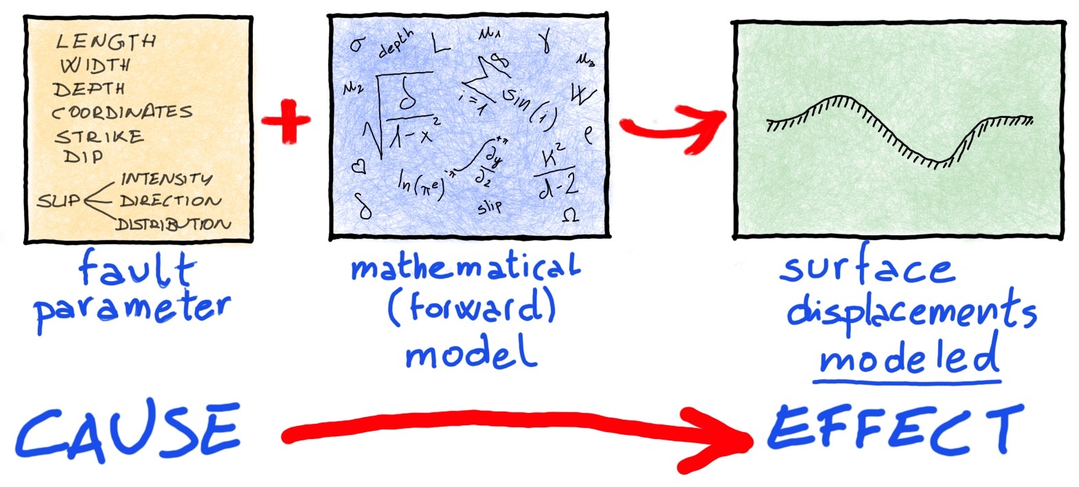 This model is also called a direct model, because starting from the causes of an earthquake (the fault) it returns the effects (the displacements). Once the displacement maps are obtained, we can compare them with those measured by SAR satellites.
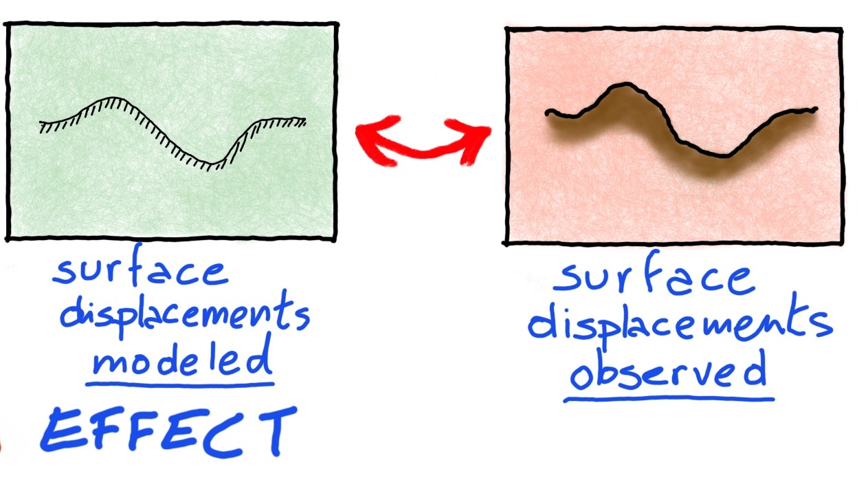 But here comes the problem: what fault parameters do we use to feed the model, if we do not know them? We are in the presence of what is called, in mathematics, an inverse problem: we see the effects of an earthquake (the deformations) and we want to infer the causes (the fault parameters).
One could go by trial and error: we change the fault parameters until we find the ones that produce the most similar displacements to those observed. This is a legitimate but impractical way: there can be hundreds of parameters, and finding the right cocktail is not easy. There are more refined tools called inversion algorithms that do just that job for us: finding the source parameters that generate surface deformations as similar as possible to those observed. 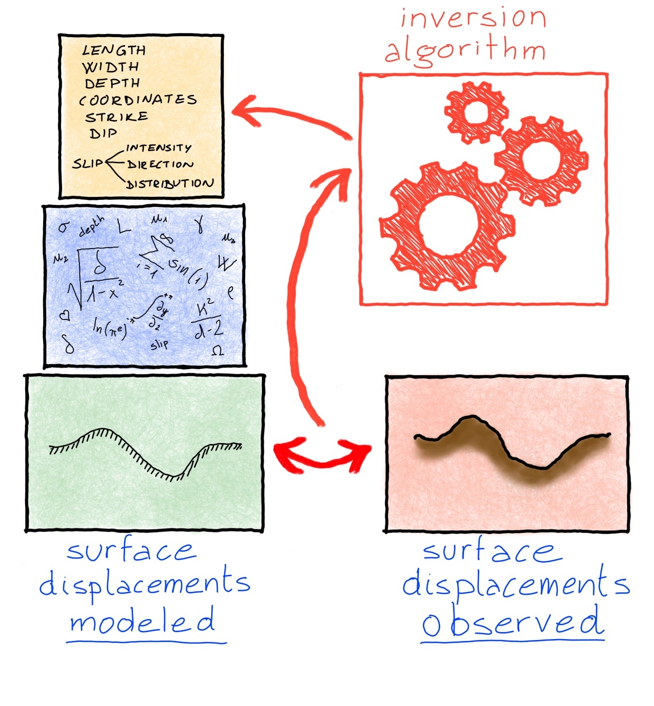 A good direct model and a robust inversion algorithm are the tools by which we find the faults published in this portal using satellite-derived data.