Although it may seem unbelievable, satellites orbiting the Earth at an altitude of hundreds of kilometers allow us to measure ground deformations of even a few centimeters! In reality, satellites do not measure displacements directly, but acquire images that, through complex analysis, describe ground deformations.
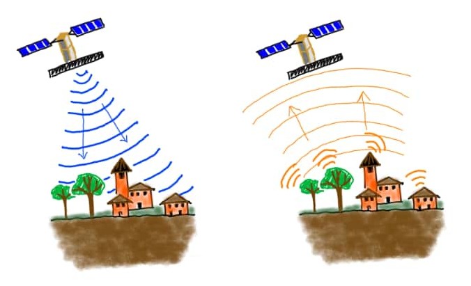
They are not photo-like images; they are radar images. And in fact these satellites are called SAR (Synthetic Aperture Radar). To acquire these images, the satellites do not need sunlight or a cloudless sky: it is the satellites themselves that send an electromagnetic wave toward the Earth and then record its return to the satellite. Somewhat like a flash, which, however, the human eye does not perceive.
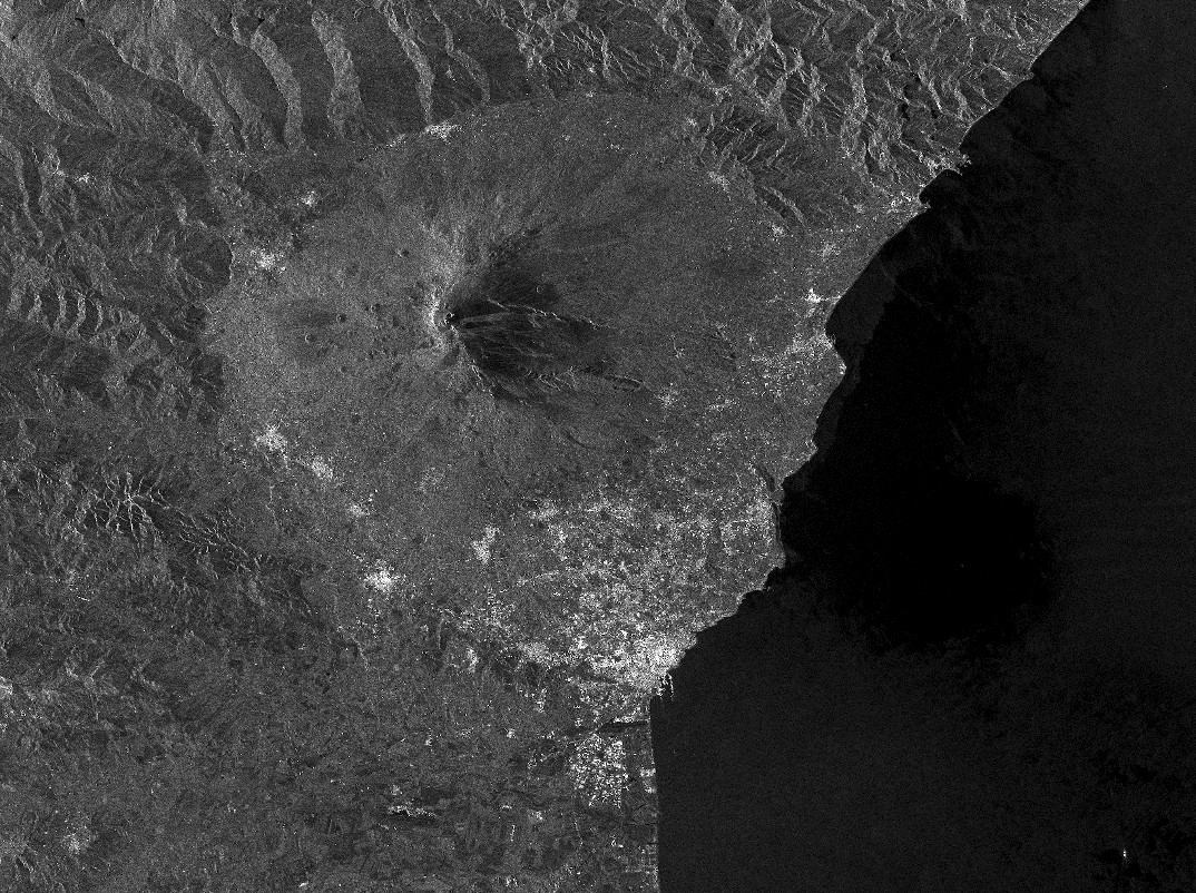
At first glance, these are not particularly interesting images. They are black and white, a bit salt and pepper, with the mountains appearing to tilt to one side. This is a SAR image of the volcano Etna, in Sicily, Italy.
Yet, these images contain very useful information. In fact, there is a technique, called InSAR (SAR Satellite Interferometry), which combines two images acquired over the same area, but on two different days, by which it is possible to reconstruct the ground deformations that occurred between the first and second image. Normally, an area is not subject to large deformations within a few days; but if an earthquake occurred in the period between the two SAR acquisitions, the InSAR technique highlights the displacements that the earthquake generated. 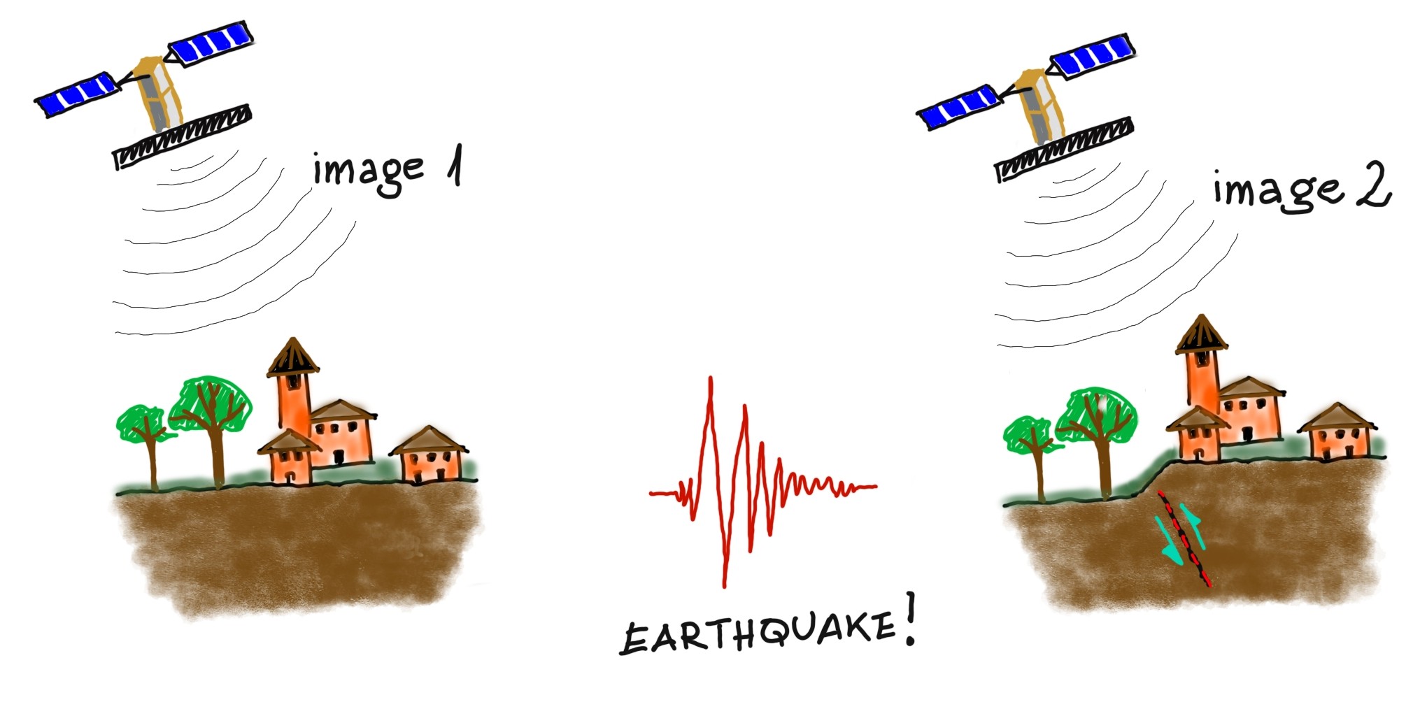 The result of this processing is called interferogram and is presented as a fringe image, where the fringes are just a measure of how much the ground has moved at a specific point.
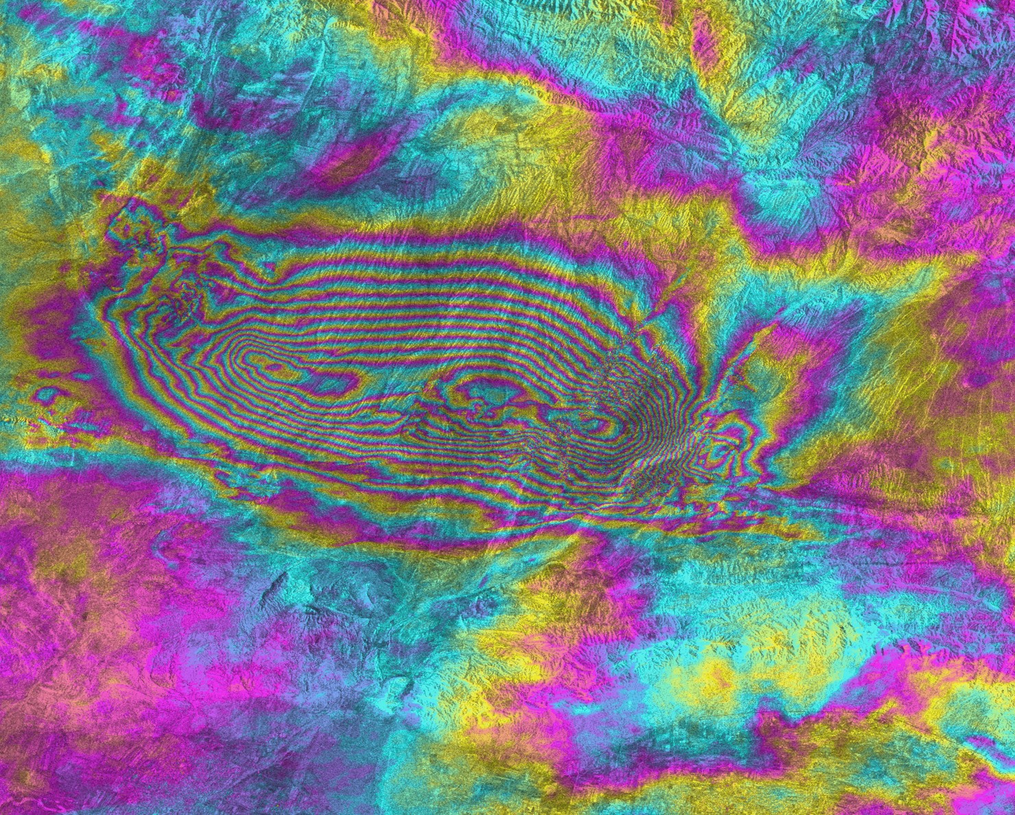
In this image, for example, each fringe corresponds to about 3 centimeters of displacement. By counting the fringes you can also tell how much the maximum displacement was.
Although an InSAR analysis is a bit more complicated than described and has several limitations (one among them: it does not work over sea), it is still a unique tool to get such an accurate map of ground deformation in a short time.
Since ground deformations are a direct result of the fault rupture that generated the earthquake, the InSAR technique allows a very accurate study of the seismic source.
Nearly all of the faults you find in the Finite Source catalog were derived from InSAR maps; to find out how, you can read how we get the fault from ground deformations.